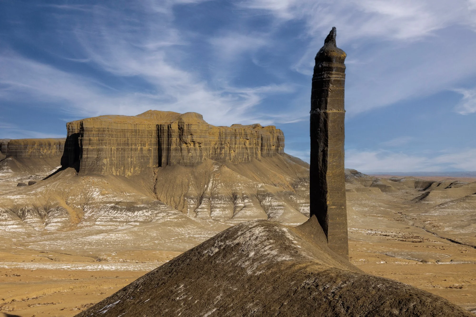
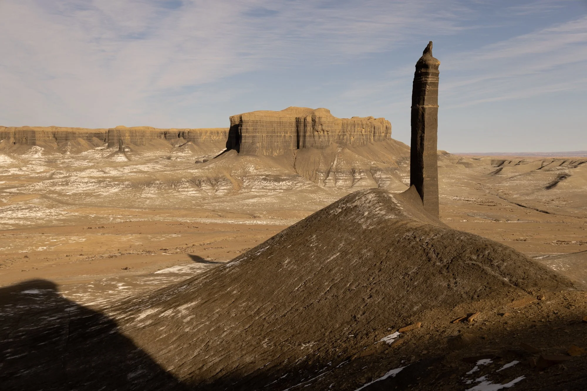
2nd Spire
2nd spire
Near Hanksville, UT
Images and location summary by Tim Wier
Trail Difficulty - MODERATE TO CHALLENGING
I would rate this trail's difficulty as 2.5 on a scale of 1-5 (with 5 being the most difficult).
The hike to this location from the parking area is an easy 3/4 mile flat walk. However, the position you have to get to for this shot is challenging as you have to hike up a dirt hill of about 40 ft, which is pretty steep. What makes it most challenging is the hill you climb- loose dirt toward the top where you have to stand - and you find yourself slipping backward every few steps. If you fall, you might roll down a ways before stopping. Another option is to fly a drone to this position and capture with a longer drone lens.
GPS Coordinates & Elevation
4,611 Ft. Elevation
Download KMZ Trail File
Click Here to download the KMZ file for this location.
Photography Tips
To get to the location of this shot, you have to hike up a pretty steep, loose dirt hill. Carefully position yourself to line up the shot.
You can capture this shot after the sun has dropped down enough to reduce the light on the Spire before the light is off the ridge in the background. Another option is to capture this shot after the sun has crested the horizon behind you and the scene is muted.
Directions
This location is about 1/2 mile southwest of The Spire, and you can access it from the same parking area.
From Hanksville, drive west on UT-24 out of town. Once you cross over the Fremont River (leaving Hanksville), drive for 6.0 miles, and you will see an open field to your right. At this point, you will see an easy-to-miss turnoff onto an unmarked and unmaintained dirt vehicle path/road heading north.
Follow the vehicle tracks on the dirt road for .5 miles, where you will come to a fork - with tracks continuing north (straight) and turning west (left). Follow the track west (left) for .5 miles, and the vehicle tracks will then turn north (right). Follow the track north for about .5 miles, and you should come to a BML post restricting driving further.
Follow the vehicle tracks on the dirt road for .5 miles, where you will come to a fork - with tracks continuing north (straight) and turning west (left). Follow the track west (left) for .5 miles, and the vehicle tracks will then turn north (right). Follow the track north for about .5 miles, and you should come to a BML post restricting driving further.
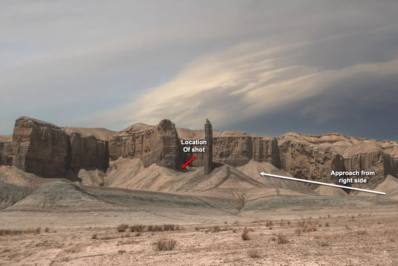
From the BLM post, you will see the 2nd Spire to the west (left) against the ridge line. Follow the vehicle tracts north and then veer to the west (right) for about .5 miles.
This shot is located on the north (right) side of the mound surrounding the second Spire. It would help if you hiked up the steep dirt mount to get as close to the top as possible.
IMPORTANT:
When driving to The Spire, you may be tempted to drive past the BLM post and save yourself half a mile or so of walking. However, parking beyond the BLM post will result in a hefty fine from a passing Ranger.
If the open field off UT-24 is wet (recent rain or snow), DO NOT ATTEMPT driving or walking to The Spire. I don't care if you drive a vehicle with 42" x 15" tires or a Sherman tank - you will get stuck.
Google Earth
EXIF Data
Focal Length – 38 mm
Exposure – 125th sec @ f 8.0
ISO – 100
Date – Feb 5th
Time – 5:15 pm
Best Time of Day to Shoot
This location is best photographed in the late afternoon or during the golden hour when the scene is void of direct sunlight.
Best Time of Year
This location can be photographed all year. However, it is best in the late fall, winter, or early spring when the setting sun comes in from the right of the scene.
Lens(es) Needed
The above shot was taken @ 38mm.
Birds-Eye View From Google Earth Pro
Permits
No permits are required in the area.
Direction of the Shot
The direction of the shot is east, around 85°.
Equipment Needed
The position of this shot does not lend itself to using a tripod, so it is best to hike up the hill and steady yourself for the shot.
Number of Other Photographers to Expect
You will likely be the only person at this location for a late afternoon shot.
Weather
The area around Hanksville has a high desert climate at about 5,000 ft. elevation. Temperatures can vary up to 30° —40° a day. Spring and fall are nice, but summer can get into the high 90s.
Cell Service
I have Verizon, and the cell service from this location is spotty. A stronger cell signal is available as you are near Hanksville.
Lodging & Camping
The area around the Factory Butte is badlands, with the closest towns being Hanksville and Caineville, Utah. There is a small camping area just off of the road to this location (not sure if it is sanctioned by BLM or not) with a makeshift fire pit. There are other camping areas and lodgings in both Hanksville and Caineville. There are 2 motels and 2 RV Parks in Hanksville and 1 hotel in Caineville.
Camping - click on the campground below for directions
Duke's Slickrock Campground & RV Park – 275 E Highway 24, Hanksville, UT 84734
Lodging - click on the lodging below for a TripAdvisor review
Muddy Creek Mining Company
(877) 711-3857
280 E 100 N, Hanksville, UT
Whispering Sands Motel
(435) 542-3238
90 South HW 95, UT
Nearby Restaurants
Hanksville is the closest town, and there are a few places to eat there. After a morning shoot, I enjoy a good breakfast (biscuits and gravy) at Duke's Slickrock Grill in Hanksville. They have great food, and nice people run the place. Stan's Burger Shak makes a good hamburger and a hardy shake, and the Outlaw's Roost makes great tacos.
Nearby Restaurants - click on the restaurant below for yelp review
Duke’s Slickrock Grill
(435) 542-3235
Stan's Burger Shak
(435) 542-3330
Outlaw’s Roost
(435) 542-1763
Area Guides and Workshops
None


